News
2022 CEAP Report
October 19, 2022
The Rainwater Basin Joint Venture Science Office is working on an NRCS Conservation Effects Assessment Project (CEAP) for the Sandhills region focusing on Eastern Red Cedar removal project delivery. The goal of NRCS CEAPs are quantifying and reporting on trends in conservation practices, and associated outcomes, over time. CEAP findings are used to guide conservation program development and support conservationists, agricultural producers, and partners in choosing the most effective conservation actions and making informed management decisions backed by data and science
 The Sandhills CEAP evaluates the impact of previous project delivery by NRCS (2016-21) compared to the impact that could be achieved using NRCS’s Working Lands for Wildlife (WLFW) framework, in terms of additional acres and grassland bird impact according to RWBJV grassland bird models. Then, the Sandhills CEAP projects how WLFW guided delivery could impact the landscape, and how that fits with 10- and 30-year goals for target grassland bird populations identified in the RWBJV Landbird Plan.
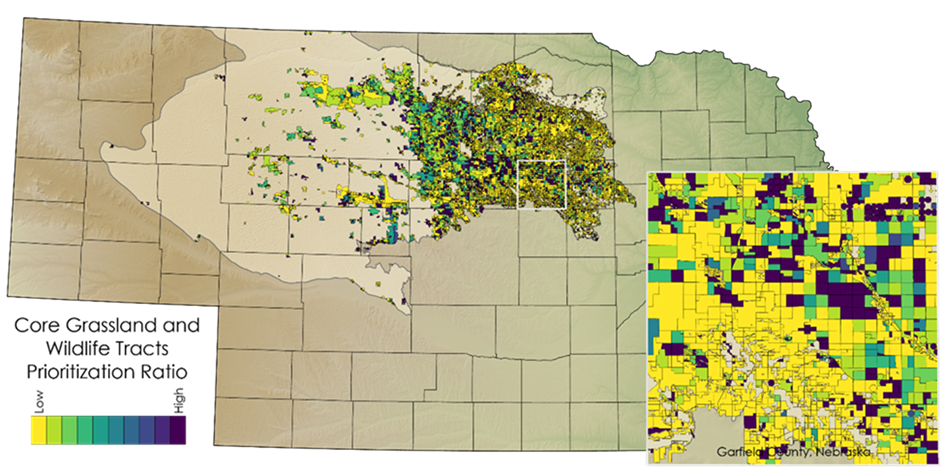
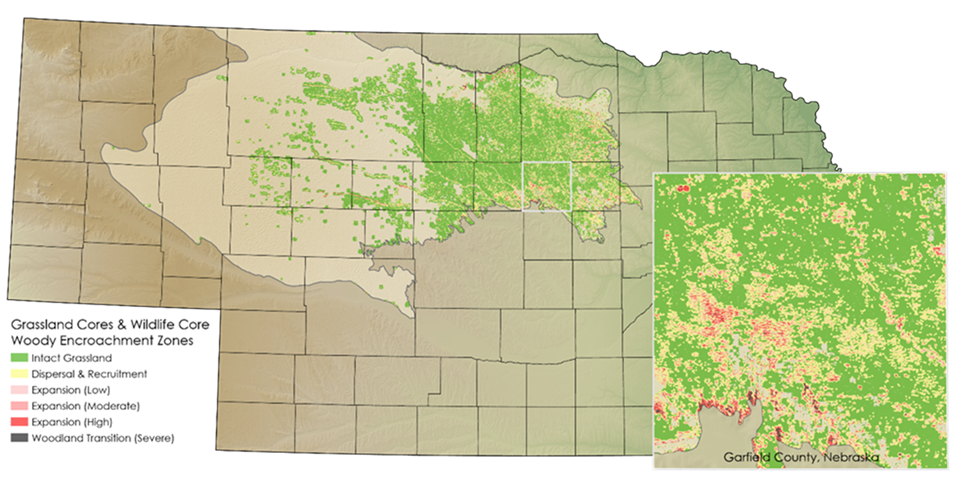
Spatial definitions of wildlife and intact grassland cores are required to implement the WLFW framework. For the Sandhills CEAP, the RWBJV defined the wildlife core as the smallest area that supports 50% of the population for the two target species with the greatest conservation need identified in the RWBJV Landbird Plan, Dickcissel and Greater Prairie-chicken. RWBJV then identified the grassland core areas and distribution of woody encroachment within the wildlife core area (figure 1). A strategy to prioritize maintenance of intact cores was identified (figure 2). While defending intact core areas, expansion of the intact core areas occur over time, through restorative tree removals. Projecting WLFW delivery and further encroachment, we can assess the potential to meet habitat goals identified in the RWBJV Landbird Plan.
For more information on the RWBJV Landbird Plan and the WLFW Framework for the Grassland Biome, see:
https://www.rwbjv.org/science-gis/joint-venture-plans/
https://wlfw.rangelands.app/assets/greatPlainsFramework.pdf