Restored Wetlands Benefit Migrating Whooping Cranes

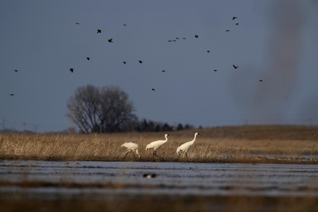
The Funk Waterfowl Production Area (WPA) had a substantial increase in whooping crane use this spring. A total of 32 whooping cranes used ponded areas on Funk WPA, and during the migration period, there were whooping cranes on Funk for at least 14 days bringing the total use-days to 89.
The first family group arrived 30 March 2023 and used the Peterson Unit for roosting, loafing, and foraging for invertebrates (bugs) and vertebrates (frogs). The second group of 4 adult birds (presumably 2 pairs) arrived 3 April. Then, a large group of 17 (3 juveniles) arrived on 14 April followed by 1 family group (2 juveniles) on 17 April. The last birds included 1 family group (1 juvenile) and 1 adult arrived 19 April and departed 23 April.
Much of this use was attributed to U.S. Fish and Wildlife Service and Nebraska Game and Parks Commission ability to complement each agency’s supplemental water deliveries to create a complex of wetlands in Phelps Co. The Nebraska Game and Parks Commission had around 70 acres of ponded water at Sacramento Wildlife Management Area that provided habitat for at least 2 family groups (6 birds), Funk WPA had 3 units with around 200 acres of ponded water attracted 32 birds, and Johnson WPA had around 63 acres of ponded water that provided habitat for 7 birds. About ½ of these ponded acres were provided through supplemental water use. In total, Phelps Co. playa wetlands attracted 45 whooping cranes highlighting the importance of these stopover areas to the birds and allow them to refuel and rest in safe areas during their long migration back to north-central Canada.
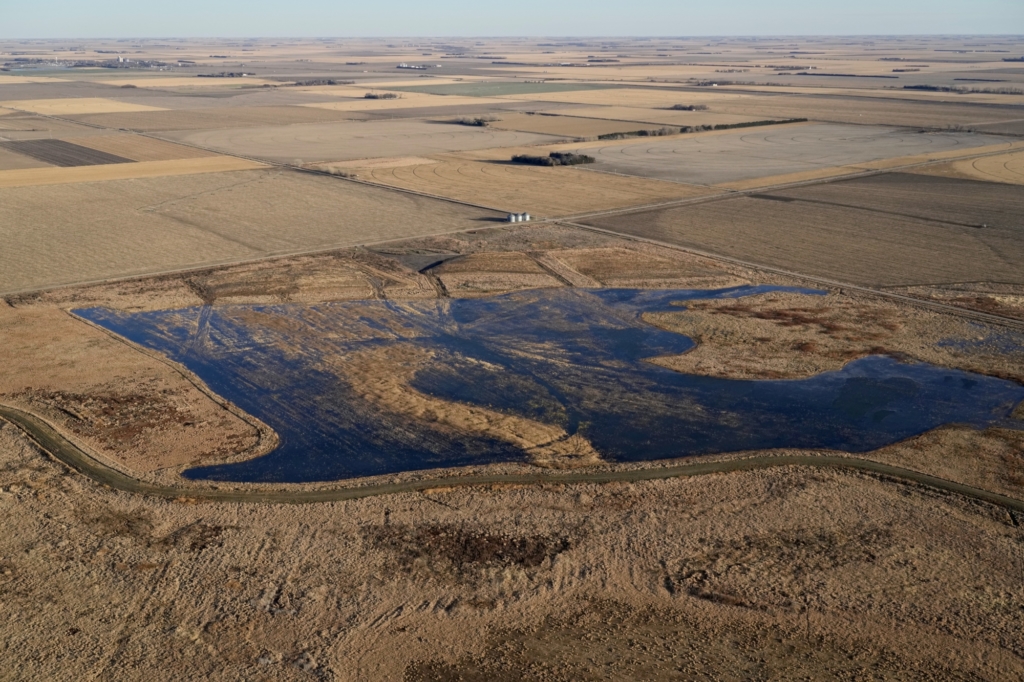
Much of the Whooping Crane use on Funk WPA occurred in recently restored wetland units. These restoration investments were prioritized at Funk WPA because it is one of the largest contiguous grassland – playa wetland areas in the Rainwater Basin. Currently, the area has 1,013 acres of restored grassland and 983 acres of managed wetland habitat. There are 3 large wetland basins that are separated by ~2 ft elevation change from the south to the north. Some of the dikes that were installed back in the early 1990’s are still intact and are used to manage water levels that maximize the available ponded habitat when possible. In total, there are 11 different areas that have water management capabilities, 6 that rely on natural surface water and 5 that have the capacity to add supplemental groundwater inputs. Recently, the partnership added a high volume canal water delivery option that can be used when high flows occur in the Platte River (see the RWBJV article on Funk Waterfowl Production Area). With the additional capacity to add water, most of the units can now be inundated as river flows allow. To maximize supplemental water deliveries significance restoration has occurred over the last three years in Mallard, Peterson, and Whitefront Units, with all three units receiving Whooping Crane use this spring.
Funk Peterson Basin – Middle Unit
Prior to restoration activities only 13.7% of the project area frequently ponded water due to extensive land leveling work done prior to acquisition had limited the ponding capacity. The enhancement work focused on removing areas of fill that were higher in elevation than adjacent areas within the 150-acre unit. A total of 169,500 cubic yards of fill and sediment was removed. The area now has the capacity to pond a contiguous body of water that is <2 ft deep across 130 acres. This has increased the pumping efficiency by reducing the amount of time it takes to provide a minimum pool area of 60 acres and has increased the amount of additional shallow (<3”) ponded areas over 50 acres.

Funk Mallard Moist Soil Unit
This 28-acre wetland was filled with up to 3 ft of dirt and land leveled for farming back in the 1960’s. In fact, so much soil had been relocated that soil survey work in the 1970’s had difficulty determining the extent of hydric and non-hydric soil series. The soil capacity data indicates that 22.7% (6.5 acres) of the project area was hydric soil. Yet, the aerial imagery from the 1940’s and topographic survey data from the 1930’s clearly depicted the extent of this temporary wetland. Using this information, the USFWS generated a restoration plan that reconstructed the wetlands shape and depth. A total of 70,100 cubic yards of fill was removed from the hydric soil footprint. This wetland can now pond up to 28 acres of water where before it did not have any capacity for ponding.
Funk White-front Unit – South Basin
Approximately 88% of this wetland unit frequently ponded water, yet the topography within this area had reduced ponded area by 63% leaving only 39 acres that frequently pond water over a 105-acre wetland footprint. The U.S. Fish and Wildlife Service restoration ecologist evaluated 1930 topographic information and found that most of the wetland was 2 ft higher than it was 90 years ago. Soil Scientists from the Natural Resources Conservation Service confirmed fill and sediment deposition, and in some areas >4 ft had been accumulated. The restoration plan for this area focused on recreating a bowl-shaped shallow depressional wetland by removing fill and sediment from areas that pond water less frequently. With a controlling outlet elevation of 2228.2 ft, 63 acres of the wetland footprint were cut to 2228.2 ft removing 114,532 cubic yards of fill and sediment creating a larger contiguous area that can pond water more frequently.
Story By: Brad Krohn, Jessica Bolser, and Jeff Drahota
All Photos By: Michael Forsberg


