
News
New Spatial Data Resources Available
May 3, 2022
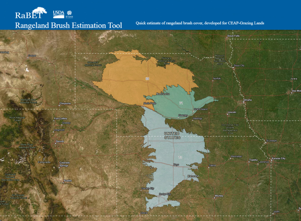 The Rangeland Brush Estimation Tool (RaBET) is a new online ArcGIS application that can be used to look at current or past woody plant canopy cover in encroached landscapes. Users can select a specific area and the application will provide a summary of canopy cover information. The percent canopy cover is defined based on the NRCS practice payment scenarios. This geospatial output will help streamline general EQIP and WLFW contract development. The RaBET application can also be used to streamline project planning for projects that are outside of NRCS programs. The RWBJV has supported field data collection, acquisition of 25 cm as well as 10 cm color infrared aerial photography. These datasets have provided the necessary training data to accurately map woody cover in the Sandhills. The Central Loess Hills (MLRA 71) and Rolling Plains and Breaks (MLRA 73) will be the next regions where this tool will be developed through data collected in 2021.
In 2016, the RWBJV collaborated with NGPC to obtain funding from the GPLCC to develop a brand new landcover map for Nebraska through the Missouri Resource Assessment Partnership (MoRAP). Landcover data is often a critical component of research and mapping projects, both for the JV and many of our partners. Considering how quickly topographies, vegetation communities, and land uses change over time, landcover data must be frequently updated or it becomes outdated and inaccurate. MoRAP has delivered a contemporary landcover product which can now be downloaded from ScienceBase. This new dataset provides the most up-to-date, detailed information on habitat types and distribution and is also consistent with landcover layers for Kansas, Texas, and Oklahoma. MoRAP developed this product with cooperation and funding from Nebraska Game and Parks Commission and U.S. Fish & Wildlife Service. RWBJV provided technical assistance.
GIS Analyst Roger Grosse has recently updated the RWBJV Project and Management Tracking Databases. These databases spatially record habitat restoration, management, and conservation activities that have been completed by the JV partners through 2021. This data will better enable the JV and partners to measure impacts of conservation delivery and track progress towards habitat and conservation goals. Contributing state partners include Ducks Unlimited, Farm Service Agency, landowner groups, Nebraska Game and Parks Commission, Natural Resource Conservation Service, local Natural Resource Districts, Pheasants Forever, Rainwater Basin Joint Venture, Nature Conservancy, U.S. Fish and Wildlife Service, and U.S. Forest Service. For more information about the database contact Roger_Grosse@fws.gov.